Menu
Weather forecast
Trieste
The Gulf of Trieste is characterized by a local breezes during the days of stable weather and serene. The typical presence of the Bora, continental cold wind coming from ENE, is more common in the winter months. It is a down wind from the Dinarides, characterized by strong gusts that can exceed 150 km/h. Episodes can occur even in the summer months are the so-called neverini, characterized by sudden bursts of wind gusts, usually from NNW, which runs out in one hour.
Bora diagram:The wind in the Gulf of Trieste is proportional to the difference baric (in hectopascals [hPa]) between Maribor and Trieste. The Bora blows when the pressure in Maribor is higher than ca. 4 hPa compared to Trieste. The higher the baric difference, the stronger the wind, even though other factors may be decisive. With pressure differences as well as the 8 hPa Bora can become violent.
Webcam C.I.S.A.R. Trieste


OSMER FVG
Situazione attuale e previsioni domani, Radar


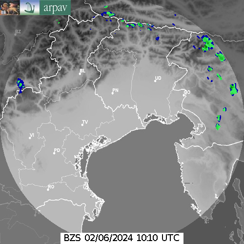
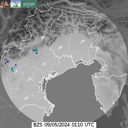
ARPA Veneto
Riflettività massima


Radar ARSO
Precipitazioni istantanee

ALADIN/SI Arso Slovenja JZ Koper
Trieste UTC 12


Wind legend
| m/s | knots | km/h | |
|---|---|---|---|
| 0 | 0 | 0 | |
| 2.5 | 4.9 | 9 | |
| 5 | 9.7 | 18 | |
| 7.5 | 14.6 | 27 | |
| 10 | 19.4 | 36 | |
| 12.5 | 24.3 | 45 | |
| 15 | 29.2 | 54 |
Diagramma della bora (Trieste)
Il grafico della bora (oggi, domani) mostra la differenza di pressione tra la località di Trieste e Maribor. Se il valore risultante è negativo, la pressione di Trieste sarà inferiore a quella di Maribor e pertanto soffierà la Bora.
- con una differenza di pressione di circa 4hpa in più a Maribor rispetto a Trieste, si attiva la Bora
- con una differenza di pressione di circa 8hpa in più a Maribor rispetto a Trieste, la Bora può risultare violenta
